The Inny is one of the most popular grade 2 rivers in Ireland, this is due to the ease of access to its put in and take out, and also due to its central location in the country. It provides a pleasant days paddling or an introduction to moving water, with plenty of short rapids to entertain.
The river has many small rapids. The most popular run is from the car park at Newcastle bridge to Ballymahon Bridge. The Newcastle bridge car park has plenty of parking and a concrete slipway with steps.
The river is mainly briskly moving flat water with several small rapids. The rapids are easily navigated. Some of the rapids contain some pour-over’s,holes,stoppers and waves, that are ideal for practising in. The Inny is the prefect location for a pleasant paddle or an introduction to moving water.
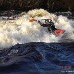
The river is also known for the Meat Factory Hole/Wave on high water. Downriver from Ballymahon Bridge an excellent wave-hole forms on higher water. It stretches almost entire width of river and forms a brilliant wave that is retentive enough to stay in as long as you want but you don't need to worry if you mess up as it will push you out quite quickly. All types of freestyle moves are possible on this wave.
This guide has a gauge but no paddling levels yet.
If you have run it, you can help. Tell us the level it needs to be worth doing (Low), and the best and highest levels if you know them. Once an admin approves them, this guide gets level colours, a place in "Running now" and a count of paddle days per month.
Suggest levels for this guideLoading levels...
Written by paddlers. If you know this river, sign in and edit these notes. Changes are reviewed before they appear.
How high the river usually gets each day, from 8 years of readings (2018 to 2026)
| Month | Typical daily high | 8 days in 10 between |
|---|---|---|
| January | 1.651 m | 1.325 and 2.144 m |
| February | 1.732 m | 1.335 and 2.271 m |
| March | 1.773 m | 1.248 and 2.146 m |
| April | 1.357 m | 1.055 and 1.765 m |
| May | 1.054 m | 0.891 and 1.321 m |
| June | 0.933 m | 0.781 and 1.112 m |
| July | 0.868 m | 0.797 and 1.049 m |
| August | 0.843 m | 0.773 and 1.557 m |
| September | 0.938 m | 0.821 and 1.543 m |
| October | 1.447 m | 0.979 and 1.953 m |
| November | 1.796 m | 0.973 and 2.147 m |
| December | 1.705 m | 1.423 and 1.989 m |
How to read this graph. The line is the typical daily high; the shaded band covers 8 days in 10. This guide has no paddling levels yet.
Past levels are no guarantee of future conditions. Readings can be late or wrong: check the river on the day. Level colours, "Running now" and paddle days are a guide only, not a sign that the river is safe to paddle. Read about gauge data and levels.
Contains Irish Public Sector Information licensed under a Creative Commons Attribution 4.0 International (CC BY 4.0) licence (source waterlevel.ie, provided by the Office of Public Works).
The take out is after the second bridge you pass, known as Shrule Bridge. Directly after the bridge, river right is a steep bank into a field right off the road. For the less sure paddler, Ballymahon Bridge is also an option, just river right after the bridge. This means you avoid the meat hole which can be messy in high water.
Interactive map loading...
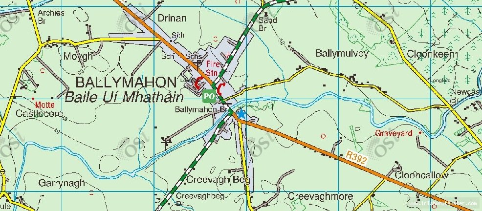
Inny River Map
Mike B