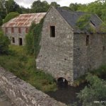
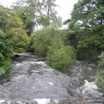
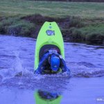
The first feature is a weir at the Mill (at the put in). In medium - high water this is a grade 2+ as it demands getting a line before a 7 foot drop or slide down the weir. There is a small stopper at the bottom which would need a bit of inspection at very high levels. After the drop there is a short white water section until the bridge (2).
The river then slows and meanders through the countryside with a few gentle wave trains. After about 1mile there is a small drop at a sharp bend and pick either left for a easy line or side drop down the right if you want some play!! Paddle on and look out for the odd wave opportunity or pour over stopper to spice up the run.
After some beautiful countryside and limited whitewater action you come to a small weir which is easily paddled over - you might want to park and play! From here the water picks up some speed as you get closer to Inniskeen village. Just after the weir there is a low bridge which may be limboed under with care. The river narrows and with the extra energy there are more wave trains and also trees to watch out for. In inniskeen village two more low bridges to consider as well as some pitch in put players who will be surprised to see you pass. A few play opportunities in the village and then the river slows a little as it passes another old mill.
Paddle on and a further @ 2miles you will see the the horizon line getting lost and the river banks rising up. This is the Amazon section an easy grade 2 series of natural steps which seem harder as it gets a little dark!!! At the end of this section there is a tail squirting eddy.. From here it is more moving water meandering on to the finish at the stone bridge....
Take out on river right before the bridge - be careful as this is a dangerous section of road...
Low bridges / barbed wire in a few places / plenty of trees and a few will be blocking the route.At the put in there is a mill race on river right which is a potential hazard.
I never had any bother - In one section there is a few private signs up for fishermen. There is a little wooden house on the banks of the river - I don't think this guy would be offering tea but I have never met him.
This guide has a gauge but no paddling levels yet.
If you have run it, you can help. Tell us the level it needs to be worth doing (Low), and the best and highest levels if you know them. Once an admin approves them, this guide gets level colours, a place in "Running now" and a count of paddle days per month.
Suggest levels for this guideLoading levels...
Written by paddlers. If you know this river, sign in and edit these notes. Changes are reviewed before they appear.
How high the river usually gets each day, from 8 years of readings (2018 to 2026)
| Month | Typical daily high | 8 days in 10 between |
|---|---|---|
| January | 0.695 m | 0.49 and 1.009 m |
| February | 0.72 m | 0.468 and 1.121 m |
| March | 0.704 m | 0.435 and 0.953 m |
| April | 0.482 m | 0.376 and 0.805 m |
| May | 0.432 m | 0.358 and 0.557 m |
| June | 0.406 m | 0.326 and 0.543 m |
| July | 0.395 m | 0.345 and 0.546 m |
| August | 0.439 m | 0.33 and 0.769 m |
| September | 0.471 m | 0.353 and 0.741 m |
| October | 0.714 m | 0.495 and 0.983 m |
| November | 0.821 m | 0.559 and 1.017 m |
| December | 0.827 m | 0.589 and 0.982 m |
How to read this graph. The line is the typical daily high; the shaded band covers 8 days in 10. This guide has no paddling levels yet.
Past levels are no guarantee of future conditions. Readings can be late or wrong: check the river on the day. Level colours, "Running now" and paddle days are a guide only, not a sign that the river is safe to paddle. Read about gauge data and levels.
Contains Irish Public Sector Information licensed under a Creative Commons Attribution 4.0 International (CC BY 4.0) licence (source waterlevel.ie, provided by the Office of Public Works).
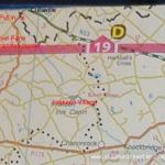
Head back to Culloville and take a right turn onto the main N53 (Dundalk direction). Travel for 4.8 miles and at Watters shop take a right turn - travel on this road until you come to a crossroads (7miles from Culloville).
Go straight through the cross and drive until you come to a T junction (10 miles from Culloville) - turn right for 0.3miles and pull in on the left above the bridge.Interactive map loading...
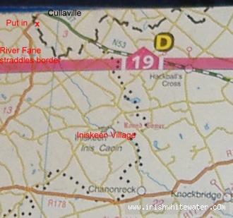
Not sure where your put out is? Have looked at this river myself recently, with a view to a paddle - looks interesting
Dave