For 11 months of the year this stretch of the Shannon is and calm and enjoyable grade 2 paddle. However, every year it floods and the fun really begins.
This section of river is the natural river Shannon channel. It runs parallel to the canal which feeds Ardnacrusha. There is always a minimum flow maintained in the river all year round to allow fish upstream.
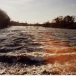
For most of the year the canal handles most of the Shannon's flow and only a small portion of the Shannon's water flows through the natural channel. But when the canal can't handle any more water the natural channel acts as a spillway. The flow can then rise to 270cumes!
This means that there can be two totally different rivers to paddle when you arrive in Castleconnell village. Flood level only happen after weeks of heavy rain far river and can take 3 or 4 to come down river.
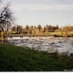
Normally at low levels there are no major hazards, maybe swans during the summer. There are a few natural weirs, but nothing that a competent paddlers needs to scouted. Just stick to the main line and things will be fine.
High levels can recognized by water in ( or almost in ) the car park at the get in or a nice eddie at the get out car park. At these levels scouting will become very difficult as the river will be so wide you will not be able to see the line from the waters edge. Best practice would be to bring someone who has paddled this stretch with you.
Many locals won’t paddle the Castleconnell run in flood because of the risks. There is one 'must make' ferry glide at the S-bends about half way down the run. The S-bends could be best described by thinking of a dense forest with a huge river flowing straight through it. Not for the faint hearted or those with an uncertain roll.
As above, when it's low its grade 2. When it's high, bring something to call for a helicopter.
Fishing is very popular on this run and I am told people pay lots of money to fish here, but the good news is that the river is wide and relations with local fishermen seem to be good. At the get in, make sure all your valuables are out of sight as there have been a number of break-ins. I haven't heard of any incidences with farmers of local land owners.
For most of the year the water level at the get in will be 3 feet below the car park level and the water will look clear. When its in flood, it will be in or nearly in the car park. I have never seen an in between level. It’s either low/normal/scrappy or high/in the car park.
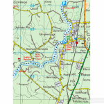
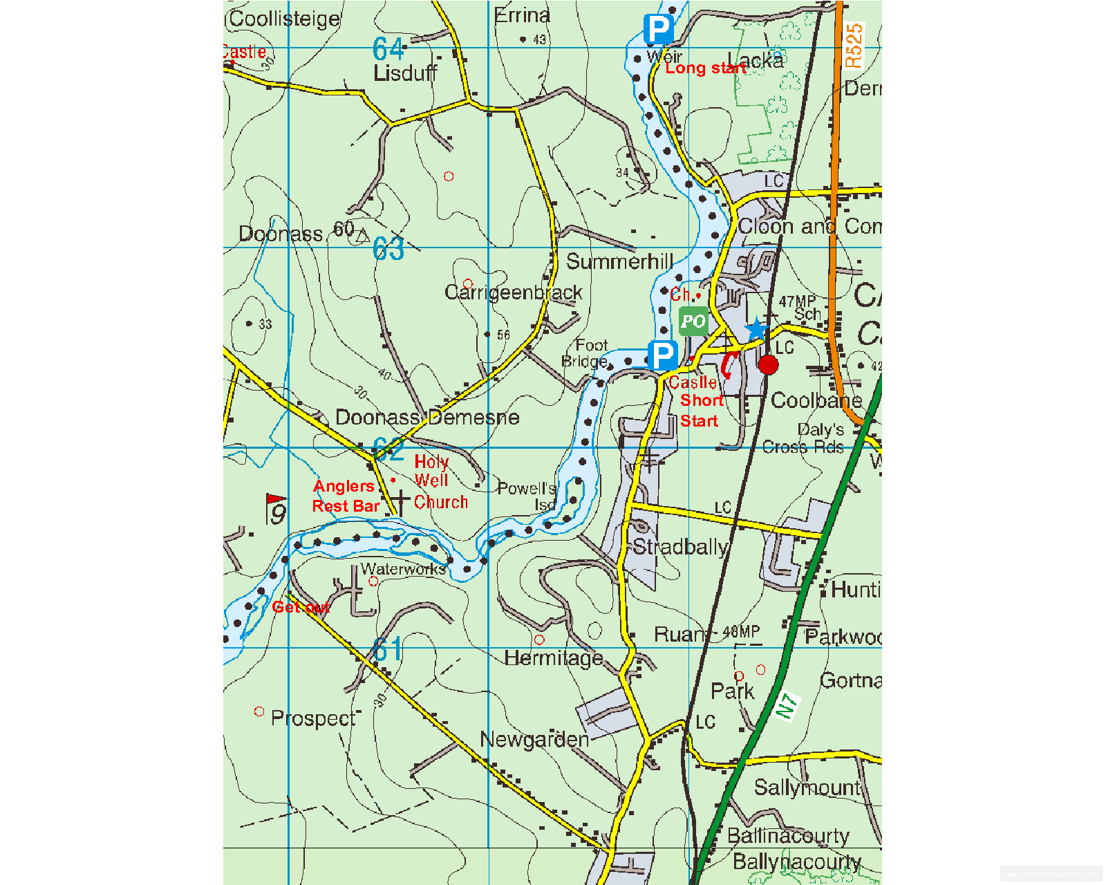
The most common place to get in is at the car park in Castleconnell village. Castleconnell is located a few km form the N7 on the Limerick Tipperary boarder.
The take out is at the Clareview water works, which is marked on most maps. Its also sign posted on the local road leading into Castleconnell. To find the get out, head south away from the get in car park towards Limerick. After about 2 km you'll see a turn right, sign posted Clareview water works. Head down this road for about another 2 km and you'll arrive at the waters edge.
Interactive map loading...
Castleconnel
Peter