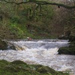
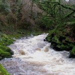
Starting at Lackandarra Bridge the river is easy enough, small rapids with potential in high water. The real stuff begins at the Gorge, this is marked by a unusually acute left hand hair pin bend where the river meets the rock at the side of the gorge.
The next 450m is littered with small drops, most of which have handy eddys after. Unless the river is in flood, its quiet shallow, so don’t be tempted to topple over or mess around.Its possible to get out before the gorge and scout or arrange rescue for a few of the first drops. The rest can be accessed a look from the pools.
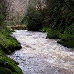
The final drop “The Salmon Leap” is the largest about 5-6ft, it washes into a flat rock wall, rescue might be needed. From here on down to the bridge on the N72 is more or less the same as what was before the gorge, small rapids, nothing to challenging and a long paddle when in low water.
Their have been one or two issues with locals in the past. Most are happy to see you. Leave as many cars at the get out as possible and try not to get caught crossing land.
Edit: There is now a serious issue with the owner (Farmer Mr. Keane) of the lands on both banks of the gorge section. He patrols the road on wet weekend days waiting to catch people walking to the get on. He drives a small light green car. When he comes upon people he follows them in the car down the road slowly to make sure they don't attempt to cross his land to the river.
Leave Dungarvan at Kilrush Service Station going towards Lismore/Cappaquin on the R672. You join the N72 at Master McGrath’s Cross (also know as The Pike). You have to take a right to get back on the R672 now heading for Clonmel.
Take the second right sign posted for Colligan Woods, 1.5km after Master McGrath’s Cross. Travel down hill and park opposite the Wooden Bridge, to check the level. The run can be tailor made to your own liking. The longest run and most tiring is 9.5km. The get on for this is at the Bridge at Lackandarra. Easiest route there is to return to the junction for Colligan Woods on the R672 and continue on for Clonmel. Take the fifth right (7.5km towards Clonmel). Travel down this road 2km where you will meet the bridge.
Access through fields left and right of bridge to the bank. (It is also possible to start further up again at Scart Bridge, see Osi photo, but I’ve never seen enough water here to make it worth while and its likely to be very overgrown.
The shorter run (which is the most fun and can easily be run over and over with a handy 10minute walk back to the get in) is to just run from the top of the gorge to the stone bridge at Colligan woods. From the car park at the Wooden Bridge continue up the road along the river, take the next right (signposted for Coolnasmear) over the river on a stone bridge. Park at the small entrance to the walking path on right just after the bridge.
To avoid trouble with the owner of the land on either side of the gorge avoid using the path down to the river beyond on the two bends further up the road.
Instead walk up to the Colligan Falls Guest house. One person walk in to the centre cottage without your boat and introduce yourself to Mr. & Mrs Beresford, ask nicely if they mind if you cross their land to the river, they never do. Once your down in the gorge you are unlikely to experience any trouble from the other landowner.
The take-out for the entire 9.5km run is at the Main Road bridge on the N72, at Radleys Engineering. Head back to Master McGrath’s Cross take the left after Quills Pub and before the Service Station.
Park on left of road beside a farm just before the bridge. Take out river left, before the bridge and through the field to the road. Watch out for the electric fences. Alternatively you can take-out at the Stone (on river left) or Wooden (on river right) Bridges at top and bottom of Colligan woods. Park discretely at stone bridge don’t block access to the walk.
Interactive map loading...
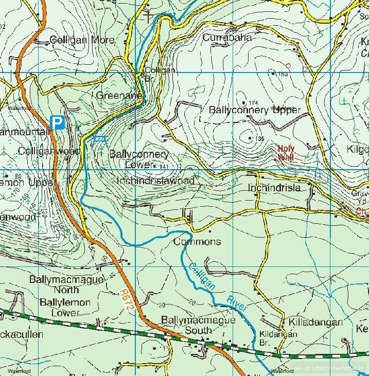
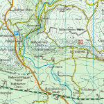
Colligan Gorge Map
John G
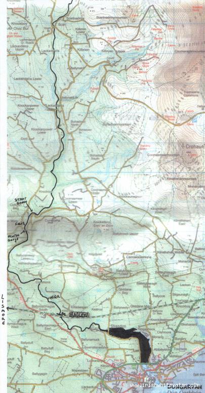
O.S.I. map of run
Michael Flynn