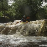
Continuous grade 3 / 4 mountain river that needs plenty of water. Caution required at all stages for trees blocking the river. Great fun.
Too many features to mention all. Scouting required at all stages. Main drop is in the upper half on the river. It is a slide leading into a 2m fall with an under cut rock on river left. A dam is located at the mid point of the river care is needed NOT to paddle to the base of the dam as water flows through a narrow chute at the dams base. Very dangerous at medium to low water. At high flows the water runs over the dam. DO NOT run the dam as it is a 7 m drop onto a very shallow rock slab. Portage the dam - get out on river left cross over the top of the dam and put on at the base of the dam on river right (using the dam to cross over).
Putting back on after the dam may require ropes for a safe decent down a 1.5 m slab to the river right bank. Slide below the dam requires scouting but is good to run at most levels. Remainder of the river is continuous small drop features with the final drop at the road bridge to be inspected as it is a man made weir and can have a large tow back at certain levels. Take out after this drop on river left.
All described previously. Always beware of river wide siphons caused by trees as they are quite common.
Private land on the right hand side of the road at the put in DO NOT park on that side of the road or enter the land.
Second last drop up stream of the Ballintrillick road bridge must be totally covered in water showing no rock for the river to be runnable. Big continuous rain required. River drains in hours.
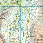
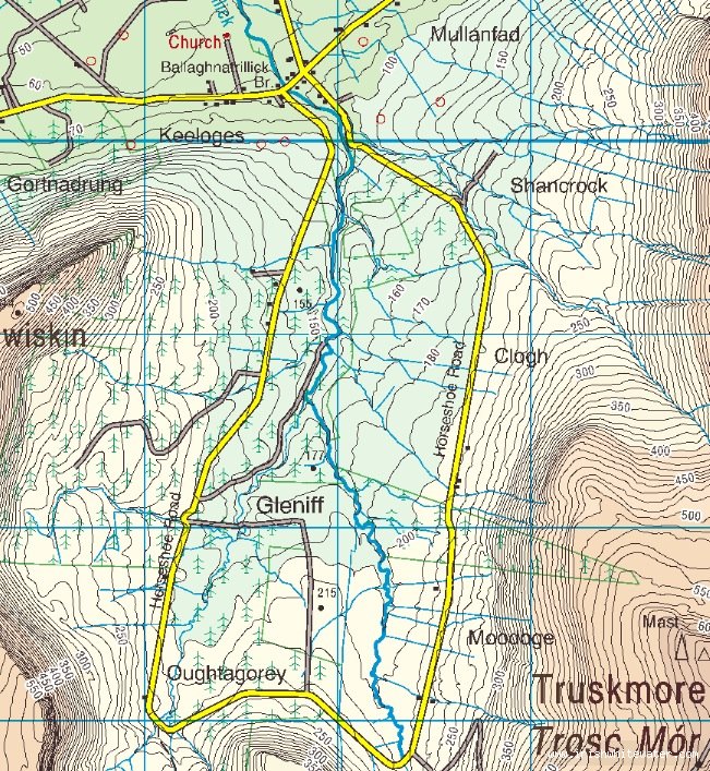
From Sligo follow the N 15 Donegal Road as far as Drumcliff, continue 4.1 KM turn right for Ballintrillilck. Continue 9.4 KM to a bridge over the Ballintrillick river (The get out). Turn right and drive up along the road following the river left bank. Continue 2.4 KM to a forestry gate on the left hand side of the road. Park here and walk to the end of this track to the put in. (10 minutes)
Road Bridge over the Ballintrillick river.
Interactive map loading...
Map
Unknown