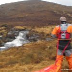
An open mountain creek starts on bedrock granite slabs then tightens in to a narrow creek with a few steep waterfalls.
Get in below the constriction below the steep slab waterfall near the top of the saddle where the creek originates. The waterfall may be runnable, though the pool is tiny and there is no exit from it.
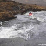
A series of tight steep sections (beware of pencilling bedrock granite), lead to an open slab section where the water hugs the left side and then leads into a narrow typical Donegal bog hill creek and more rocky slides.
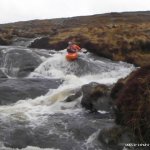
After a while there is a 3m waterfall which can be scouted on the walk up, this trends left into a hallow in the left wall at the bottom, but is generally straight forward slide/slot. After is a broken fall which has some rocks at the bottom so keep straight and nose slightly up, not big enough to pencil. A rocky slide with a tight right at the bottom end the rapids and the creek bimbles onwards to the road bridge.
Typical moountain rock bashing, the usual hazards to be aware of.
Doesn't seem to be any issues as only the totally dedicated would take the walk up there with creek boats. There are no fences to cross and no lifestock to disturb. It is high up in the mountains so there isn't anything to disrupt.
Look at it from the road and if it floats a boat then its a goer, but make sure its still raining as by the time you walk up the water will have run off.
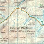
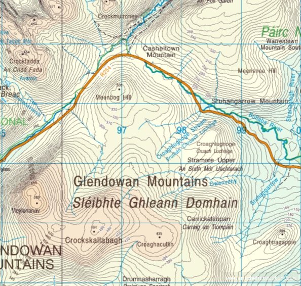
On the R254, coming from Letterkenny direction, as it passes through the Glendowan mountains with Glenveagh National park on its North. The river is about 1.5km up in the mountain and can seen as you drive NW along the left side of the road when there is lots of rain.
Parking is same for both get in and get out, as its a walk up the mountain side and finishes at the park where the cars are.
Interactive map loading...
Owenvehy
Bart