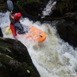
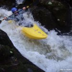
A pushy fast flowing steep river with lots of drops.
The river starts quickly with fast flowing water and straight into the first two drops 3 foot and then 4 foot. Its good to stay river right as most people sub out and capsize river left.
Then straight into the third drop, a long slide into a big pool. The fourth drop the other end of the pool is very technical with no clean line with lots of boulders to trip you up. The fifth drop is straight forward enough a boof into a shot boulder garden.
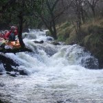
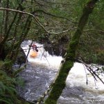
A really long boulder garden is next, with lots for nice moves to be made but eddies are small. After the boulder garden is a mellow section leading into a few shelf drops. Beware of trees. Another mellow section leading into the final two drops and the take out is a steep bank river right.
The bank is lined with lots of trees and often block the river make sure you know what is ahead.
Check from the road if its runnable. It needs lots of water to make it good.
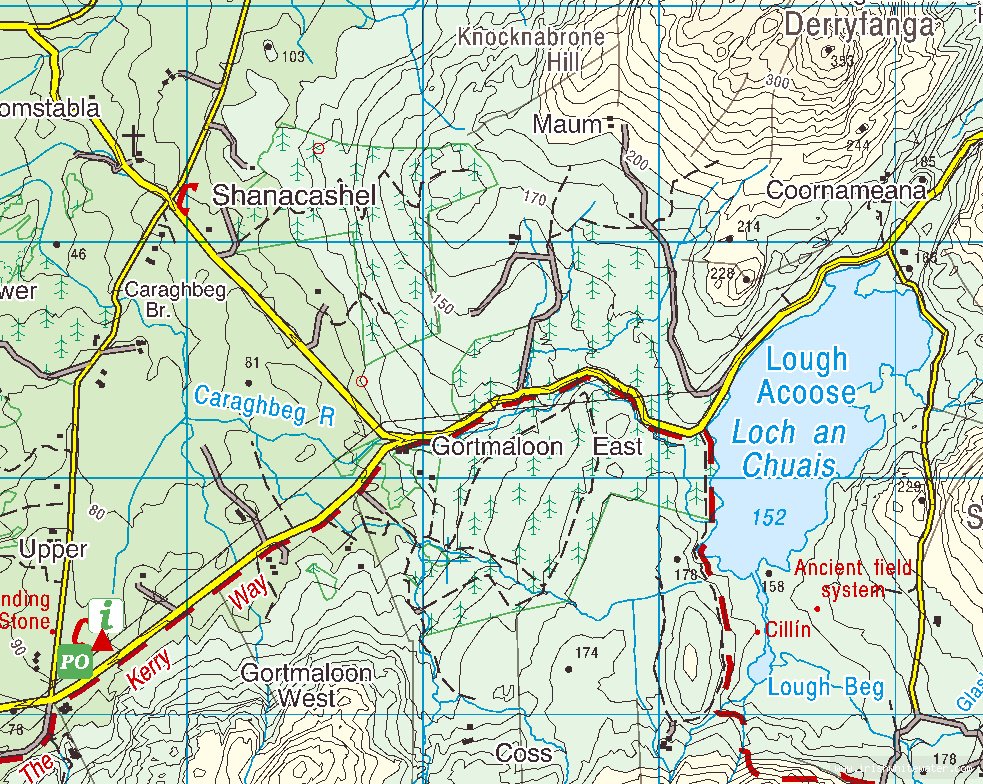
From Killarney take the road to the Gap of Dunloe and follow the signs for Glencar and head towards the Owenroe and the Upper Caragh. just as you arrive in Glencar you will see a lake, Lough Acoose.
This lake the feeds for the river. About One kilometre down the road there is a layby on the left beside the lake. This the get in.
This can be a particular hard river to find as the back roads in the area are all very similar, and lacking in recognisable land marks. Consult the map to get a good feel for its location. The least complicated route to the Caraghbeg and Lough Acoose achieved by travelling 13km directly south from Killorglin.
1km down the road from the get in the road forks, park here for the get out. On the river get out before the bridge as a dangerous strainer is just after the bridge.
Interactive map loading...
Caraghbeg river
Peter