Upper Lee River

Cork, Munster Grade: 2 - 3 ~0.3 km

Brief Description
A short run of 200 to 300 meters of continuous grade 2/3 white water. 40 minutes from Upper-Bandon.
River Description

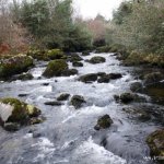
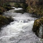
A lot of rain is needed to make this river worth running. The river starts at a large pool. It gets narrow by trees before the bridge. After the bridge there is a boulder garden for a short section and leads into the first drop the slot. Make sure to stay river left as the right line has a dangerous tree on it.

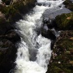
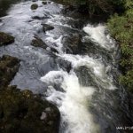
The next drop is the main drop and has a big stopper in the middle and can be seen from the road before getting on. From here on the river only has a few 2 foot drops and a nice play spot at the get out.

Safety & Access
Hazards
A major hazard is the tree river right on the first drop.
Access Issues
Access at the get in is a bit difficult as the farmer has pad locked put barbed wire over his gate so I think he does not welcome visitors onto his land. An alternative get in may be needed. But locals wave and smile at paddlers as they walk back up the banks.
Directions to Put-in

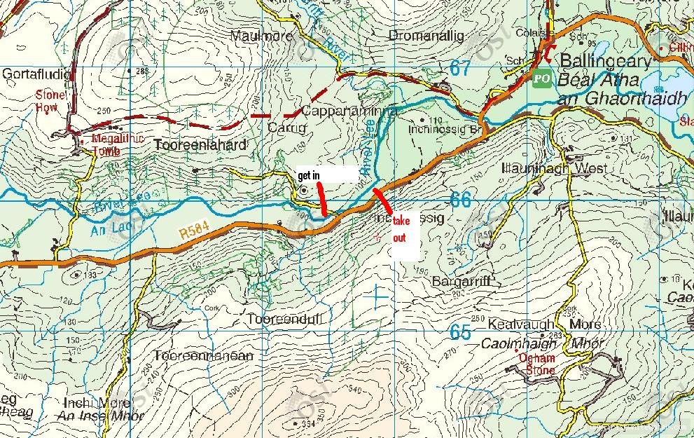
Take the R584 from Macroom to Inchigeelagh, Ballingeary. Pass right through the village of Ballingeary passing an unusually large house on the right and head towards Gougane Barra still on the R584.

Less than 2km out of the village you will see the river on your right. the turn off to the right is just a few meters up the road and is sign posted Carraig and Tooreen Leathard (Tooreenlahard). Take this turn off and park just after the bridge. You can see a pool over a gate to your left this is the put in.

Directions to Take-out
The run is so short its not worth doing a shuttle. The best thing about this river is you can run back up to the top and run it over and over again. the take out is 200-300m down stream at a short flat section where the newly reclaimed field ends.
Map

Interactive map loading...

Map Photos
Map photo

Unknown

Location & Navigation
GPS Coordinates & External Maps
Takeout

Take Out

Lat: 51.8407960 Lng: -9.2499300

Putin

Put In

Lat: 51.8388770 Lng: -9.2544470

Version Information
Version: 0
Last Updated: 06 Dec 2009
Author: joey geluk
River Statistics

1

Versions

GPS Points

7

Photos

0

Videos