This river is graded from 3-4, it needs to be bank inspected in its entirety as trees can be washed in and pose a serious hazard.
Do not assume it is clear of trees.
For the record this river was first paddled by Bernard Doherty, Seamus Kelly and Patrick Kelly, big thank you to Terence Gallagher for the heads up on this one many moons ago.
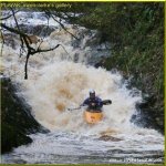
The run starts out as a steady grade two with a short technical section after one hundred meters. If you are having problems with this GET OUT NOW.
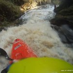
This is followed by a small series of rock ledge type drops of grade three leading to a two meter drop.The Beast Hole follows shortly after this drop. It requires scouting and safety. The drop consists of a slide of approx. twenty meters into a deep pool, at the bottom of which is a severe stopper in high water.The Coffin hole is immediately after this pool and must be portaged as it contains a siphon which can only be seen at low water and is severely undercut. Portage on river left.After this the river contains a few small grade three features following on to the second bridge.
Coffin Hole is a death trap.
Beast hole has a difficult stopper and as it comes so close to the coffin hole careful consideration must be given to rescue.
Rocks are particularly slippery in this area.
No known issues
From bridge at take out, if water is covering all rocks this is a nice run. If there are large stoppers, you had better know what you are doing.
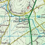
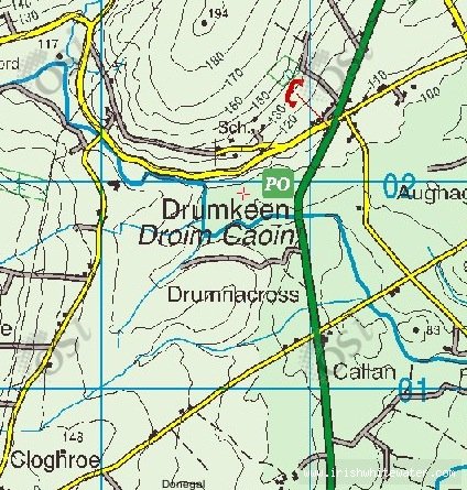
To reach the put in you turn right into Drumkeen village coming from Letterkenny and follow the main road for approx 1 mile. The put in is at the first bridge on your left. There is parking for two cars.
The take out is on the main Letterkenny to Ballybofey road at the lower side of the bridge.
The take out is immediately below the bridge on the main Letterkenny/Ballybofey road.
Interactive map loading...
Map
Johno