Unsure of features, see video. More information needed once paddled
Grading due to water levels
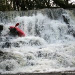
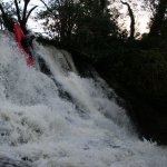
I have paddled this one at a low-medium level. Extreme caution is required for this one, it is a boat breaker, especially over the first 4 drops. There is also no phone coverage in this area, so you would want to know what your doing!
Each drop on this river lands on a shallow river bed. Inspection is vital. From the put in, there is four drops, each containing a very shallow river bed. The 3rd drop in this series is there's only one that has a deep pool. The last drop (as can be seen from the video) contains a lot of rock facing back up river and a very shallow bottom. The rest of the river has a few wee drops (approx. 1ft) and a lot of low lying trees. There is also a large collection of trees gathered towards the bottom, a huge strainer and no way through near the get out.
Interactive map loading...
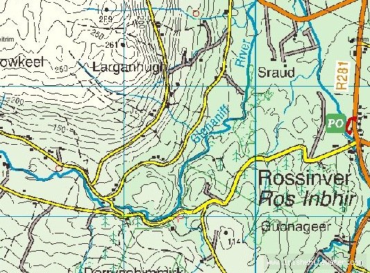
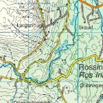
Glenaniff Map
Seanie
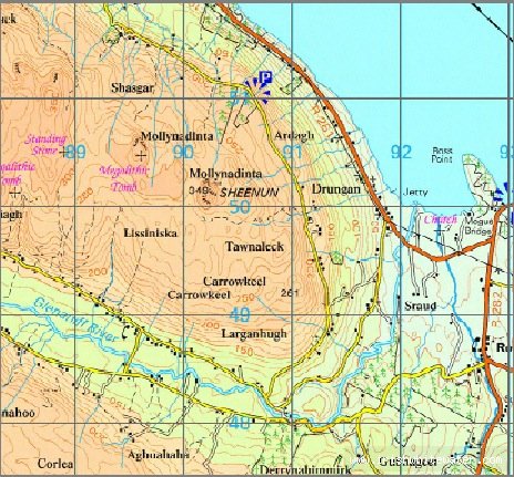
Glenaniff Map
caolan