Cummeragh River

Kerry, Munster Grade: 2 - 3 3.8 + 1.4 flat

Brief Description
The river Cummeragh is a nice grade 2 to 3+ river with a natural channel that is a bit narrow in places.
River Description

The river is a natural lake fed channel that holds it water for a long time after rain.

When you get on at Cahersavane bridge the land is soft and boggy and the river flows gently around a few bends before picking up the pace.

From then on the river stays continuous grade 2 or 3 for just over 3km. There are a number of drops on the river ranging from a 1m to 1.5m high.

The river twists and turns regularly so maintaining line of site requires a lot of effort at times.

The banks are steep and thorny so any swimmers will be slow running down stream chasing their gear.

Eventually a paddler arrives at Lough Currane where there is a scenic 1.4km flat water paddle to the get out.

Safety & Access
Hazards
As the river twists so much it can be hard to see whats coming next. Eddies are often only big enough for a few boats so 'leap-frogging' will be required.
Access Issues
At the get out a local B&B owner was very quick to come out of his house shouting at us to move on when we were parked on the public road outside in front of him, hence we parked in the car park with the fishing boats.
Water Level Information
We ran this river when the Clydagh ( and more or less everything else in Kerry )was far too low to paddle and still had an enjoyable paddle.
Directions to Put-in
This river drains into Lough Currane near Waterville Co. Kerry. To drive to the put in, as you arrive in Waterville from the south, turn right off the main N70 road into the village centre then right again onto a local road that runs along side Lough Currane. Follow this local road until you arrive at Cahersavane Bridge (OS Sheet 83). Get in just upstream on Cahersavane Bridge.
Directions to Take-out
We parked ( with permission ) in the car park that fishermen use beside Lough Currane. See map for location of this car park. The road at the get in is narrow but still its possible to park a few cars there.
Map

Interactive map loading...
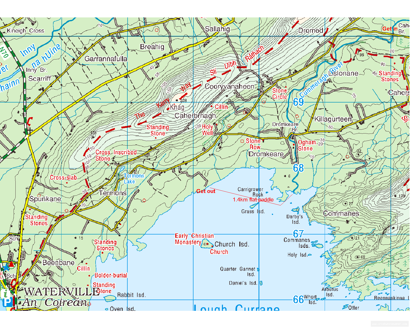
Map Photos
Cummeragh river Map

Cummeragh river Map

Peter

Location & Navigation
GPS Coordinates & External Maps
Takeout

Take- Out. Paddle across the lake to this take out.

Lat: 51.8434170 Lng: -10.1296740

Putin

Put-In

Lat: 51.8643050 Lng: -10.0908350

Version Information
Version: 0
Last Updated: 25 May 2009
Author: Peter OSullivan
River Statistics

2

Versions

GPS Points

1

Photos

0

Videos