A narrow continuous river that runs when the upper and source are extremely high. Its not really an alternative to the upper but a fun run in to it.
This is a short, 10 minute stretch with few eddies on the way down. At the get on the river is extremely narrow and is not more then a small stream. There is fairly continuous gradient bar a flat section in the middle. The main feature of the run is a 4-5 foot slide part way down.
There is a tree across the river about half way down that is easy to pass on the right. Also there is a steel girder bridge at the bottom which, even if covered when you get on, may be above water when you reach the bottom.
No access issues noted.
The river is running when the source and the upper are in spate. If the metal girder bridge where it joins the Upper Liffey is covered, its good to go.
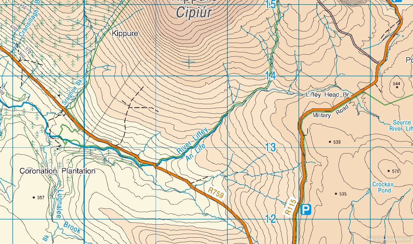
Located on the western side of the Sally gap about 2 km west of the crossroads on the R759. This river is located beside the Upper Liffey, it runs into the upper just below the get on.
Drive back across the bridge at the get on for the Upper Liffey, so that you are on river left. Keep going for a bout half a mile up the road. You will be able to see the Cem on your right, where teh river meets the road, that is the get on.
Interactive map loading...
Someone mark the put-in?
Fergal