I suggest getting on just down stream of the farm house. Around here there are trees that need to be portaged. Up stream of here is less interesting.
The river has many bends and small drops. In total it drops around 40metres between the lake and the Get out, or around 25 from the shorter Get in to the Get out.
During the last third of the river there are two larger drops. Both are narrow and easy to inspect.
You can walk up to the two larger drops from the get out. Depending on the group and the level you might want to set up rescue.
Trees up stream of the farm house.
If you paddle from the take out to the start of the Upper Carragh there are a number of barbed wire fences across the river which could cause trouble in higher water.
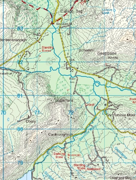
As you arrive at the Get in of the Upper Carragh , at Bealalaw Bridge, turn left. Follow this road for 3km and turn right. You will go over a bridge, the River carragh, at the next bridge you will arrive at the Get out for the Owenroe.
There is parking here on the right hand side of the road.
Follow this road up stream either to Cloon Lough or as far up as the farm house on the right hand side of the road.
Interactive map loading...
Owenroe Kerry
Seanie