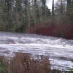
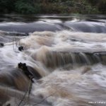
Only works after a lot of rain, possibly a grade three, very short run at approx. 800 M. Parts are shallow so swims may be a little bumpy.
Handy for a quick run returning or going to Easky/Enniscrone.No major rapids as such just a sequence of small holes and waves along the course of the river. Very easily scouted from the car on the drive up.
There are salmon runs built on this river the main one is located just at the put in on river right, just be careful off it, nothing else to speak of really.
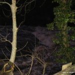
Tree on top drop at the moment. Avoidable but beware.
Park sensibly at the top, might be worth asking in the hotel as its their car park and it is closed at evening time. Moy fisheries do have salmon runs on the river but I've never seen anyone fish this stretch, but be polite.
No gauge as such but if its above the foot bridge on the right located 300M. above the put in then its worth running.
Traveling from Dublin N5 (Foxford N26)
* Proceed into Ballina with the train station on your left following the signs for Sligo N59.
* Go through two sets of traffic lights then take last exit to the right on a mini round-about.
* Proceed through next set of traffic light then take first exit on mini round about at Dunne's Stores, passing the tax offices.
* Follow the road the over the bridge(river Moy) turning left. Proceed along with the river on your left passed the town park & tennis courts.
* You will then come to a set of traffic lights at the end of a bridge(this bridge spans the river Brosna. Take the immediate right turn at the lights, onto Downhill road. The river is running parallel to the road on your right hand side.
*Put in is at the large car park on the right just after the Downhill hotel.
You passed it on the way to put in. The bridge for the main Sligo /Ballina main road. Steps on river right before the bridge are the recommended exit as getting off after the bridge involves a long walk.
Interactive map loading...