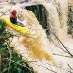
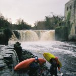
Park and Huck, roughly about 5 meters, Better run in high water as the take of is fairly bony and the landing shallow.
The rapids above the drop are not worth running, to run the falls, you can ferry across to the island(above the river right side of the Drop.
River right beside the housing estate is fine, people have melted down off it and not had any problems Also the run right of centre line which is close to the slab can be made if willing to run it. Its a fun drop and usually theres a crowd watching.
Theres not much place to set up rope rescue here unless someone sets up below the drop on river left on the mill bank.
No specific hazards noted.
No access issues noted.
Loading levels...
Written by paddlers. If you know this river, sign in and edit these notes. Changes are reviewed before they appear.
If the Ballisadare is running, this is also.
Typical number of days each month the river is at a paddling level
| Month | Typical paddle days | Driest year | Wettest year | Years with at least one paddle day |
|---|---|---|---|---|
| January | 21 | 12 | 26 | 8 of 8 |
| February | 22 | 0 | 28 | 7 of 8 |
| March | 19 | 6 | 23 | 8 of 8 |
| April | 5 | 0 | 17 | 6 of 8 |
| May | 0 | 0 | 5 | 2 of 8 |
| June | 1 | 0 | 7 | 4 of 8 |
| July | 1 | 0 | 13 | 4 of 8 |
| August | 12 | 0 | 16 | 6 of 8 |
| September | 2 | 0 | 14 | 7 of 8 |
| October | 22 | 6 | 28 | 7 of 7 |
| November | 24 | 9 | 30 | 8 of 8 |
| December | 25 | 16 | 30 | 8 of 8 |
The best months on the Colooney Falls are February, November and December, with 22 to 25 paddle days in a typical month. Summer is usually still worthwhile, with around 5 paddle days in a typical June to August month.
How to read this graph. A paddle day is a day the gauge reached the guide's Low level (0.8 m). Each bar is the middle year of 8 (2018 to 2026). Tap a bar for the driest and wettest years.
How high the river usually gets each day, from 8 years of readings (2018 to 2026)
| Month | Typical daily high | 8 days in 10 between |
|---|---|---|
| January | 0.882 m | 0.648 and 1.171 m |
| February | 0.901 m | 0.649 and 1.263 m |
| March | 0.817 m | 0.575 and 1.149 m |
| April | 0.636 m | 0.474 and 0.892 m |
| May | 0.506 m | 0.385 and 0.704 m |
| June | 0.468 m | 0.356 and 0.732 m |
| July | 0.495 m | 0.363 and 0.835 m |
| August | 0.647 m | 0.358 and 0.964 m |
| September | 0.625 m | 0.472 and 0.932 m |
| October | 0.878 m | 0.641 and 1.126 m |
| November | 0.936 m | 0.669 and 1.155 m |
| December | 0.944 m | 0.697 and 1.19 m |
How to read this graph. The line is the typical daily high; the shaded band covers 8 days in 10. Dashed lines are this guide's levels.
Past levels are no guarantee of future conditions. Readings can be late or wrong: check the river on the day. Level colours, "Running now" and paddle days are a guide only, not a sign that the river is safe to paddle. Read about gauge data and levels.
Levels for this guide: whitewater.guide (CC licensed).
Contains Irish Public Sector Information licensed under a Creative Commons Attribution 4.0 International (CC BY 4.0) licence (source waterlevel.ie, provided by the Office of Public Works).
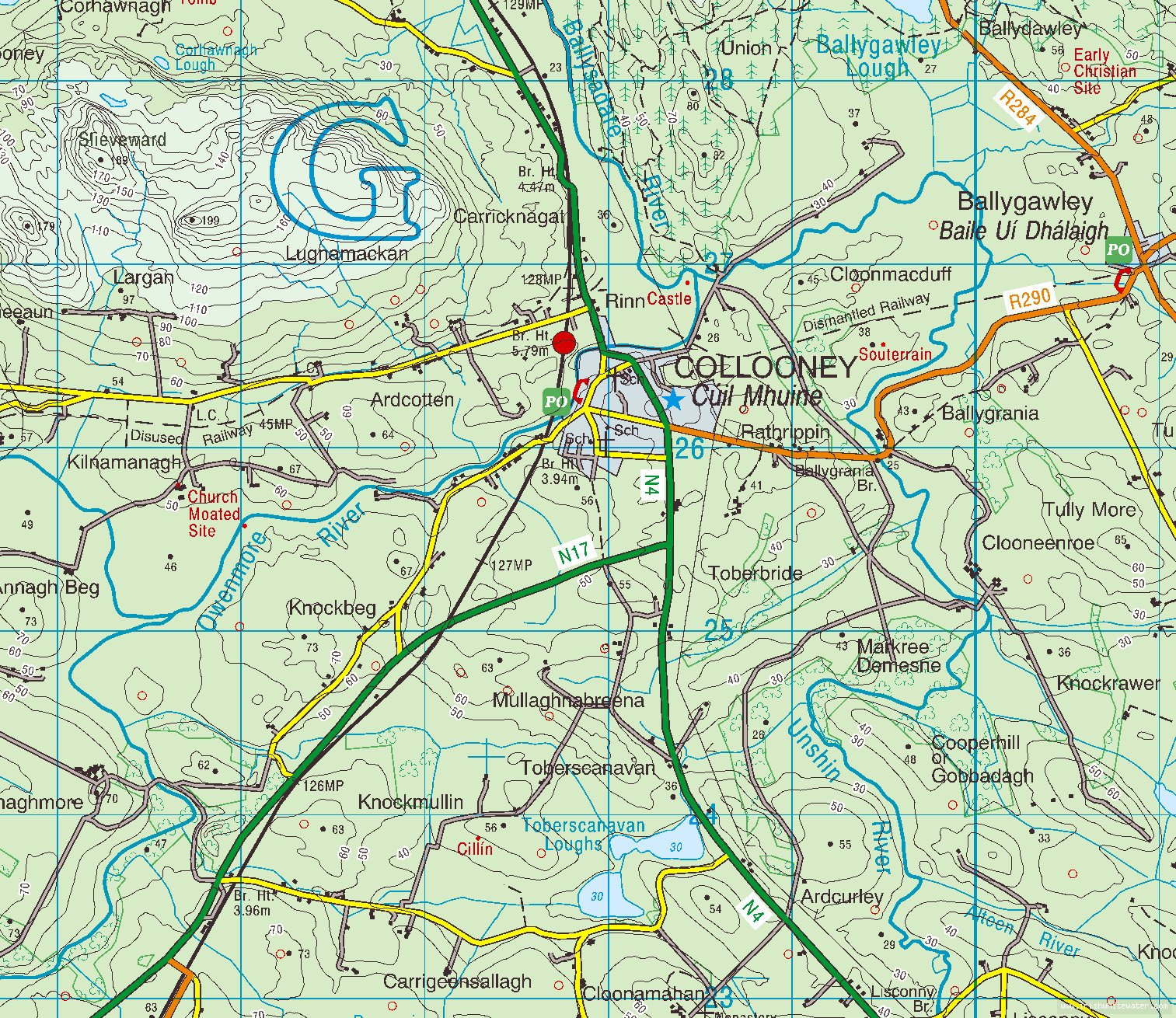
Colooney is 3 mile from Balisadare on the old Dublin road, when you enter the village park anywhere around the bridge, The falls are located about 400 meters upstream from the bridge.
The bridge in town.
Interactive map loading...
Peter