It's really just two drops unless you want a major hike-in.
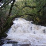
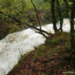
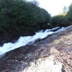
Two drops separated by about 300m
First is a 2.5 m vertical drop that needs to be boofed as theres some pin potential
Second is sweet- a slide that drops at a 45degree angle-sideways as well as down.
Worth doing if in area but dont make a special trip.
More rapids upstream if you're a creek freak and dont mind a hike.
Downstream is more or less flat until the harbour where theres another small drop
There is a left bank tributary, the CANROOSKA, about halfway between Pooleen and Glengarriff.
BY road on left is a small layby signed"Waterfall Walk". This has a 2 stage drop followed by 500m of class 3+ then 500m of class 2. This is good fun. But it's a big water run. Don't bother unless its lashing for several hours. When i ran this the Flesk was over 2m on the gauge and there was just enough here.
Photos of Pooleen in flood, Canrooska and potential first descent rapids upstream of pooleen at
https://picasaweb.google.com/115854755078169673426/GlengarriffRiver#
Not too bad.
Pooleen is the local swimming hole in the summer. Natives generally friendly
Look at the slide. If most of the scour holes are covered- go for it.
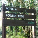
Just off the N71 in Glengarriff woods.
Go into the Glengarriff Nature Reserve, you'll eventually come out onto a public road again (go left), next you'll cross a narrow bridge going left on a bend, you then pass Glengarriff lodge on the left, keep going and you eventually see a picnic area on the left with a sign for Pooleen Wood, park hear and start walking upstream by the fence. The slide isn't very far up from the car park.
It's 3km from the Gates of the Nature Reserve to Pooleen Wood.
Same as put in. Enter the National forest, follow the road until you see a sign marked Pooleen. Park in the picnic area.
Interactive map loading...
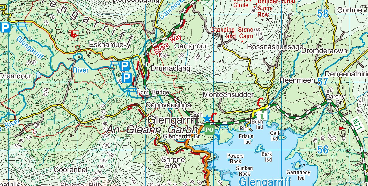
Glengarriff
Peter