The Lee fields section of the Lee is the most paddled section of the river; used by freestyle, polo, long-distance and beginner paddlers. Phoenix canoe club are based on this stretch and both UCC and CIT canoe clubs hold sessions here regularly.
The Lee has two hydro-electric dams (at Innascarra and Carrigadrohid) so it's flow depends on the electricity demand and the time of year.
The Lee Fields car park, Carrigroane road:
Long distance paddlers get on at the slipway here and paddle up stream.
Phoenix Canoe Club (based on river-left on the Lee road):
Phoenix canoe club run beginner courses and play polo from their containers on the Lee Road. When river levels are low they erect polo goals at this site and this is where the Cork Cup polo competition is held . More information can be found on their website www.phoenixkayakclub.com
The Weir:
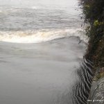
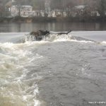
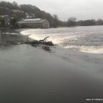
The Weir curves across the width of the river, broken in the middle by a fish-steps. At low water levels the weir can be run any where along its length but at higher levels sticky stoppers form all the way from the fish-steps to river left and from the fish-steps to a few meters to the wall on river right. The Cork Rodeo is often held here.
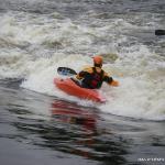
At low to medium levels there are playspots on the river left and river right corners of the weir. The water flowing over the weir isn't very deep so expect to bottom out at times. Ploughs are usually installed near the river right bank for competitions. in low water you can run the weir slide at the river right to avoid getting stuck on the weir face
At very high flood levels, a fantastic wave forms on the far river right edge of the weir. It is very fast and has a very big surfers left shoulder making righty moves a doddle. Landing the moves can be tricky although as it usually waves into the the horrible horrible hole next to it, making for some tricky manoeuvres to get back on the wave. Very enjoyable.
The Sluice:
Downstream from the Weir on river left is the Sluice. Here the Lee splits into two dropping about 2 meters over a concrete sill. This side of the Lee is tidal so the type of hole at the sill will depend on the height of the tide and the level of the Lee above the Sluice. Generally a low tide will give a sticky hole while a high tide will flush out the hole, the type of hole can change over a single session.
In medium water and a low tide this feature becomes known as the hole of death. It has been known to chew people and paddless to the great amusement of onlookers. And is perfect level for the most recent cork rodeo's. Crowd entertainment is what its all about.
At high levels the Lee flows over the concrete around the Sluice and the gap might be difficult to spot from upstream. Local paddlers sometimes install wooden ploughs at this spot over the summer to improve the hole. Most hole moves can be done, depending on the level.
Also during an incoming tide, and very high river levels, some waves form along the rocks below the sluice, at the right levels, the hole in the wall spot can form a great wave/hole feature, and on that perfect day, when everything is right, two really fast waves can form, nice and wide with well defined shoulders each side, the spot is shallow and makes any move attempts a feat of great bravery but if done to perfection, big moves and no rock rash can be had.
Ballincollig Weir
Close to Lee fields, in Ballincollig theres a weir on the Lee just off the Innascarra road with two long weirs on both sides and a 9 maybe 10 foot drop in the middle about 20 foot wide. It has a big pool about 8 foot deep at the bottom of it. In low water its very good for beginners. In high water it would be a good play spot as two holes form at the base of both weirs and the gates right and left. But caution is required on the right hand side of the river (side close to the walkway). There is approximately 3 Iron bars erected at this site that can be quite dangerous. There's a park at the put in were you can leave your car, the weir is about 600 yrds down stream.
- At high flows watch for trees etc. coming downstream.
- On mid-terms from school and all summer long, young people with rocks are an issue.
- Very fun but can also be very dangerous. Quite often the hole will not want to let you wash out even after a paddler swims. Caution is required.
Fishermen: Fishermen slouch on the river-right bank of the weir and at low levels fish from the weir itself. The Sluice can also have fishermen on the river-left bank. Keep an eye out for "six-pack" fishermen.
Parking: There is a car park upstream of the weir in the Lee Fields. There is also limited parking outside of the Coca-Cola factory (please don't park in the Coca-Cola yard unless parking has been arranged).
Loading levels...
Written by paddlers. If you know this river, sign in and edit these notes. Changes are reviewed before they appear.
Level (measured just downstream of the weir):
Very high: Lee Fields on the 9 o'clock news, Carrigroane road flooded, water pouring down the steps between the railings.
High: Water level with the edge of the old concrete wall that the railings sit on. Fish-steps covered.
Medium: Halfway up the wall, fish-steps visible
Low: Water ankle deep on the weir-face.
Typical number of days each month the river is at a paddling level
| Month | Typical paddle days | Driest year | Wettest year | Years with at least one paddle day |
|---|---|---|---|---|
| January | 31 | 28 | 31 | 7 of 7 |
| February | 27 | 18 | 29 | 7 of 7 |
| March | 31 | 26 | 31 | 7 of 7 |
| April | 24 | 10 | 30 | 7 of 7 |
| May | 12 | 7 | 25 | 7 of 7 |
| June | 8 | 1 | 20 | 8 of 8 |
| July | 7 | 1 | 21 | 8 of 8 |
| August | 10 | 0 | 23 | 6 of 8 |
| September | 16 | 3 | 26 | 8 of 8 |
| October | 30 | 25 | 31 | 7 of 7 |
| November | 30 | 24 | 30 | 7 of 7 |
| December | 31 | 25 | 31 | 7 of 7 |
The best months on the Lee are January, March and December, with 31 paddle days in a typical month. Summer is usually still worthwhile, with around 8 paddle days in a typical June to August month.
How to read this graph. A paddle day is a day the gauge reached between the guide's Low and High levels (0.2 to 1.6 m). Each bar is the middle year of 7 (2019 to 2026). Tap a bar for the driest and wettest years.
How high the river usually gets each day, from 7 years of readings (2019 to 2026)
| Month | Typical daily high | 8 days in 10 between |
|---|---|---|
| January | 1.227 m | 1.111 and 1.385 m |
| February | 1.235 m | 0.524 and 1.485 m |
| March | 1.186 m | 0.361 and 1.32 m |
| April | 0.613 m | 0.032 and 1.193 m |
| May | 0.189 m | 0.017 and 1.121 m |
| June | 0.103 m | -0.034 and 1.057 m |
| July | 0.038 m | -0.088 and 0.934 m |
| August | 0.092 m | -0.153 and 1.189 m |
| September | 0.207 m | -0.083 and 1.201 m |
| October | 1.203 m | 0.474 and 1.372 m |
| November | 1.239 m | 0.582 and 1.496 m |
| December | 1.217 m | 1.037 and 1.448 m |
How to read this graph. The line is the typical daily high; the shaded band covers 8 days in 10. Dashed lines are this guide's levels.
Past levels are no guarantee of future conditions. Readings can be late or wrong: check the river on the day. Level colours, "Running now" and paddle days are a guide only, not a sign that the river is safe to paddle. Read about gauge data and levels.
Levels for this guide: whitewater.guide (CC licensed).
Contains Irish Public Sector Information licensed under a Creative Commons Attribution 4.0 International (CC BY 4.0) licence (source waterlevel.ie, provided by the Office of Public Works).
The Lee fields are found just west of Cork city centre on the Carrigrohane road. Head out from the city centre, towards UCC. Continue on the N22 past UCC, then take a right onto Carrigrohane road when you reach the Crows Nest restaurant. The Car park is about 400m ahead on the right hand side.
At or close to put in.
Interactive map loading...