Glencree River

Wicklow, Leinster Grade: 2 - 5 4 to 6 kms

Brief Description
Steep, very steep in the early sections easing to meandering river for the last couple of kms.
River Description

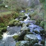
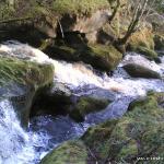
Top section in Glencree is ridiculously steep and littered with trees. Bank inspected from the confluence with stream from Lough Bray Lower to confluence with stream from Lough Bray Upper. Nice, defined drops and constrictions. Some landing on rocks but may be cushioned when water is high enough to run. Trees tend to obstruct lead in or exit from most drops.

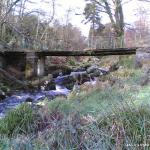
By the time the Wicklow Way meets the river it has lost all it's altitude and is reasonably flat.

Safety & Access
Hazards
Artificial weir/ledge in Glencree with rocky landing. Possibly more dirty drops and constrictions. Trees always an issue.
Access Issues
River access is not easy unless attempting from Glencree. Otherwise hiking in will be required. Good forest track on south side of river near stream from Lough Bray Lower.
Water Level Information
Needs A LOT of water.
Directions to Put-in
Glencree River from Glencree Church to confluence with Dargle.
Directions to Take-out
Take out at Onagh Bridge or continue on to join the Dargle.
Map

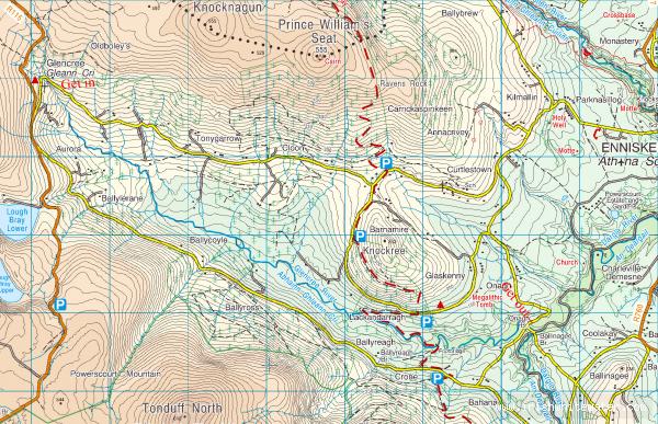
Interactive map loading...
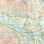
Map Photos
Glencree River

Glencree River

Peter

Location & Navigation
GPS Coordinates & External Maps
Takeout

Take Out

Lat: 53.1708390 Lng: -6.2011340

Putin

Put In

Lat: 53.2004990 Lng: -6.2920070

Version Information
Version: 0
Last Updated: 26 Jan 2007
Author: Colm Healy
River Statistics

1

Versions

GPS Points

4

Photos

0

Videos