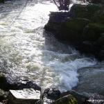
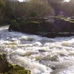
The Maigue is an ideal river for beginners. There are twelve weirs on the river, with short flat water between them. Some of the weirs are good for playing in.
In a number of place the river splits in two, its best to go river right always.
In high water some of the weirs can have large stoppers. Avoid the banks at the weir directly upstream of a stone effect footbridge at the golf course as there are steal re-bars sticking out.
There is lots of wildlife to be seen also, such as otters.
Maigue in Bruree
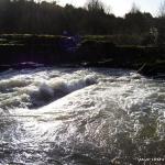
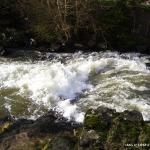
There is another section of the Maigue in Bruree Limerick. You can park in the picnic area before the bridge (if coming form limerick city) Put in above the weir if you want to run it, other wise anywhere along the bank will do. The river runs into a narrow channel creating fast white water good for beginners. In lowish water there are three holes, but in high water a small wave is made at the entrance to the channel.
There no specific hazards, some of the stoppers become retentive at high levels. The stoppers shouldn't hold people(not unless you've gotten on when the water is way too high) Sculling out to the end of the weirs maybe required.
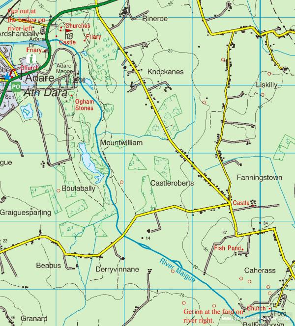
Drive in to Adare manor, park beside the hotel and look at the weir, if the water is big and brown and the weir is washed out don't get on.
The river is located near the town of Adare. Travelling from from Limerick towards Adare on the N21, take a left (first exit) at the first roundabout (small roundabout) after the dual carriage way ends. Travel along this road for approximately 5km, you will go around a sharp left bend followed by a sharp right bend. After these bends there is a turn right with a sign post for a restaurant, at the end of this road is the river. There is space for about five cars.
The river take out is at the bridge at the main road (N21) on the way into Adare from the Limerick side, beside the ruins of an old monastery. There is space to park about 100 metres from the bridge on the Adare side both on the main road and in the Church car park (limited space). Get out on river left downstream of the bridge.
Interactive map loading...
River Maigue
Peter