It's a short run about 1.4 km in length. Grade 3 sometimes grade 3+. Expect some weirs and a short gorge section.
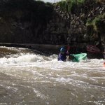
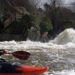
At the get in beside the pump house there is a weir with a hole.
The pump house hole only becomes a hole from about 1.3 or 1.4 on the gauge. Before that it's a shallow breaking wave and is easily shot. This has been run at 2m in playboats and was no real problem.
A rapid follows the pumphouse hole. Lots of eddies are available all down the left bank at all levels. At higher levels (1.8m+) a few sticky holes form along here. You can see well ahead and the left bank is free of trees from shortly after the pumphouse.
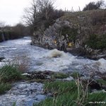
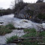
The flow slows a little as you reach an angled weir. There is a fishbox here which is generally safe though seldom run. You can run the weir anywhere about the middle of it's complete width. At higher levels the weir will only be marked by a ripple. Lower levels mean a drop off of at most 2 feet.
The next weir is commonly known as the "death weir". There are few water levels where the left side is safe. Avoid the left altogether as it can often hold large branches also. There are few levels that the fishbox in the centre is a true problem. You must ensure that the nose of your boat stays up when you hit the bottom of it though as the box ending is walled off. Alternatively you can take a line barely right of the right wall of the fishbox and drop into a small pool below. Low water levels usually mean you need to be careful here as the pool will be shallow.
A short rapid follows bringing you to the "gorge". This is most likely the only place you will require rescue setup. You can view the gorge by staying on the pool above where it stretches around the left side. In most water levels you can enter the rapid by paddling up the viewing pool and crossing over to the river right side. The top part of the gorge is slacker water and gives ample time for setup by staying quite far left. The water speeds then and makes it's way into and/or around a large boulder in mid flow, marking the end.
At low levels, right of the rock is the only way to go and is a simple line.At high levels (2m) you will need to enter the gorge via a slight rockslide between 2 stoppers and stay left of the rock which will not be visible and will form a hole behind it. In the mid levels you will need to make a choice before entering the rapid. To make the left line you must cross a folding wave/stopper that feeds water directly into the rock. Hit this far left or you'll get pushed towards the rock. To make the right it will take very few determined strokes to keep right as the folding wave will give you a bit of an extra push.
Following the gorge there are 2 weirs. The first should be shot on the left. The second shot on the right (though this one is less of an issue). Paddle on through mild rapids to the finish. (There may be some waves or stoppers beneath the bridge)
- At the start of the gorge section you can eddie out river left to look at the drop. This eddie is behind the aeroboard factory.
- Suspect water quality.
- Lack of headroom at the bridge at the end.
At the get in:
- Make sure you close the gate
- This is someone's private land, asking them nicely before driving through their property would be a good idea.
- Be careful not to get stuck in the mud, stick to the path.
At the get out:
- I haven't heard of any break ins, but make sure no valuables are visible.
- Be careful of little kids at the end, they swarm around looking as if they are going to rob everything.
Loading levels...
Written by paddlers. If you know this river, sign in and edit these notes. Changes are reviewed before they appear.
There is a gauge at the get in. Its easy to judge when you see it. Before driving to the top look at the bridge at the get out and check if there is space to paddle under it or trees blocking it.
Typical number of days each month the river is at a paddling level
| Month | Typical paddle days | Driest year | Wettest year | Years with at least one paddle day |
|---|---|---|---|---|
| January | 11 | 5 | 19 | 8 of 8 |
| February | 14 | 0 | 22 | 7 of 8 |
| March | 10 | 1 | 19 | 8 of 8 |
| April | 2 | 0 | 5 | 5 of 8 |
| May | 0 | 0 | 2 | 2 of 8 |
| June | 0 | 0 | 1 | 2 of 8 |
| July | 0 | 0 | 6 | 3 of 8 |
| August | 0 | 0 | 10 | 3 of 8 |
| September | 0 | 0 | 12 | 3 of 8 |
| October | 10 | 2 | 17 | 7 of 7 |
| November | 18 | 3 | 22 | 8 of 8 |
| December | 17 | 9 | 21 | 8 of 8 |
The best months on the Deel are February, November and December, with 14 to 18 paddle days in a typical month. Summer is hit and miss: a typical June to August month gives no paddle days, but July had at least one paddle day in 3 of the last 8 years.
How to read this graph. A paddle day is a day the gauge reached the guide's Low level (0.8 m). Each bar is the middle year of 8 (2018 to 2026). Tap a bar for the driest and wettest years.
How high the river usually gets each day, from 8 years of readings (2018 to 2026)
| Month | Typical daily high | 8 days in 10 between |
|---|---|---|
| January | 0.661 m | 0.352 and 1.834 m |
| February | 0.708 m | 0.32 and 2.218 m |
| March | 0.542 m | 0.296 and 1.595 m |
| April | 0.314 m | 0.234 and 0.682 m |
| May | 0.235 m | 0.19 and 0.39 m |
| June | 0.222 m | 0.18 and 0.324 m |
| July | 0.214 m | 0.157 and 0.462 m |
| August | 0.22 m | 0.147 and 0.526 m |
| September | 0.271 m | 0.153 and 0.728 m |
| October | 0.57 m | 0.272 and 1.614 m |
| November | 0.79 m | 0.303 and 2.17 m |
| December | 0.829 m | 0.382 and 2.149 m |
How to read this graph. The line is the typical daily high; the shaded band covers 8 days in 10. Dashed lines are this guide's levels.
Past levels are no guarantee of future conditions. Readings can be late or wrong: check the river on the day. Level colours, "Running now" and paddle days are a guide only, not a sign that the river is safe to paddle. Read about gauge data and levels.
Levels for this guide: whitewater.guide (CC licensed).
Levels for this guide: RiverSpy colour bands.
Contains Irish Public Sector Information licensed under a Creative Commons Attribution 4.0 International (CC BY 4.0) licence (source waterlevel.ie, provided by the Office of Public Works).
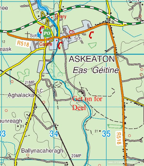
The river runs through the town of Askeaton Co. Limerick.
Travelling from Limerick on the N69, turn off for the town of Askeaton. Go through the town and over the bridge, turn left, travel along this road past the Aeroboard factory. Take the next turn left, sign posted "Deelside Stud", and follow the road upriver (you should see it from the road). Here you arrive at a farm. This is someone's private land, asking them nicely before driving through their property would be a good idea.
Go through the gate ( AND CLOSE THE GATE AFTERWARDS ) follow this path carefully ( horses in the field) until you arrive at a pump house. This is the get in.
Its about a 50 minute drive from Limerick city.Get out below the bridge in Askeaton. Lots of parking down there on the river right bank and at a community centre a little further down.The bridge is easy to recognise, a stone one with a castle beside it.
Interactive map loading...
River Deel
Peter