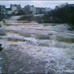
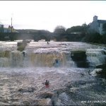
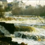
Roughly a fifteen foot waterfall followed a small pool with a continuous gradient for a hundred and fifty meter section of ledges and rocks.
River right has a faster moving chute with a salmon gate on the far right which is best avoided.
No specific hazards noted.
Loading levels...
Written by paddlers. If you know this river, sign in and edit these notes. Changes are reviewed before they appear.
Typical number of days each month the river is at a paddling level
| Month | Typical paddle days | Driest year | Wettest year | Years with at least one paddle day |
|---|---|---|---|---|
| January | 1 | 0 | 4 | 4 of 7 |
| February | 0 | 0 | 9 | 2 of 7 |
| March | 1 | 0 | 3 | 4 of 8 |
| April | 0 | 0 | 0 | 0 of 7 |
| May | 0 | 0 | 0 | 0 of 8 |
| June | 0 | 0 | 0 | 0 of 8 |
| July | 0 | 0 | 3 | 2 of 8 |
| August | 0 | 0 | 2 | 2 of 8 |
| September | 0 | 0 | 3 | 1 of 8 |
| October | 0 | 0 | 3 | 3 of 7 |
| November | 1 | 0 | 4 | 4 of 8 |
| December | 0 | 0 | 5 | 2 of 7 |
The best months on the Ennistymon Falls are January, March and November, with 1 paddle day in a typical month. Summer is hit and miss: a typical June to August month gives no paddle days, but July had at least one paddle day in 2 of the last 8 years.
How to read this graph. A paddle day is a day the gauge reached between the guide's Low and High levels (0.97 to 1.25 m). Each bar is the middle year of 8 (2018 to 2026). Tap a bar for the driest and wettest years.
How high the river usually gets each day, from 8 years of readings (2018 to 2026)
| Month | Typical daily high | 8 days in 10 between |
|---|---|---|
| January | 0.611 m | 0.433 and 0.894 m |
| February | 0.685 m | 0.446 and 0.928 m |
| March | 0.599 m | 0.384 and 0.908 m |
| April | 0.395 m | 0.319 and 0.678 m |
| May | 0.37 m | 0.285 and 0.562 m |
| June | 0.365 m | 0.271 and 0.601 m |
| July | 0.406 m | 0.267 and 0.765 m |
| August | 0.455 m | 0.307 and 0.768 m |
| September | 0.456 m | 0.338 and 0.775 m |
| October | 0.655 m | 0.449 and 0.885 m |
| November | 0.732 m | 0.494 and 1.532 m |
| December | 0.702 m | 0.447 and 0.882 m |
How to read this graph. The line is the typical daily high; the shaded band covers 8 days in 10. Dashed lines are this guide's levels.
Past levels are no guarantee of future conditions. Readings can be late or wrong: check the river on the day. Level colours, "Running now" and paddle days are a guide only, not a sign that the river is safe to paddle. Read about gauge data and levels.
Levels for this guide: whitewater.guide (CC licensed).
Contains Irish Public Sector Information licensed under a Creative Commons Attribution 4.0 International (CC BY 4.0) licence (source waterlevel.ie, provided by the Office of Public Works).
Located in the heart of Ennistymon village in county Clare. Down an alleyway in the sign posted "Ennistymon cascades".
Parking next to the falls or on the street.
Interactive map loading...
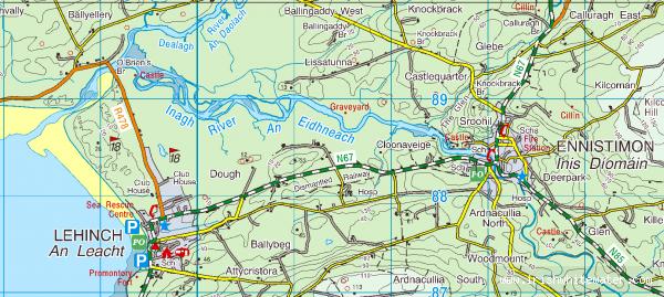
Ennistymon falls
Peter