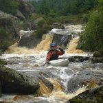
Tight technical rocky paddling at its best, continuous fun!
Soon the river joins with two others and increases in pace and and volume. The rapids get steeped and scouting is advised. Things will calm down after the main stretch for a short while but be alert trouble is around the corner sooner than you think. A long triple rapid is coming up with some tree obstructions. Possible grabby holes here but nothing too crazy, just hit them straight on.
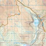
After that lough Dan will come soon and you will enjoy the conversation about how one may best avoid the necessary paddle across it.
Paddle through the trees to find the exit at the bottom of the lake and if there is water for it, enjoy the big volume blast down the Upper Annamoe and Annamoe.
No specific hazards noted.
Get out at Lough Dan at the put in for the upper Annamoe. Its the longest shuttle i've done in Ireland, about 1 hour. Park at the bridge here
Better yet, if there is water for it and there should be if you're getting on here, paddle the Upper Annamoe and Annamoe. Its amazing how much fun it is at this level. Also the shuttle is much shorter!
Interactive map loading...
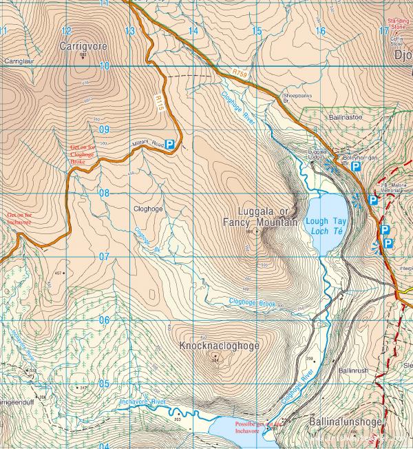
Get on and get out for Inchavore river.
Peter