Continuous sections of boulder garden rapids with few flat sections and no major large drops or obstacles (except trees!).
Its ideal for a group breaking into grade 4 rivers as it has lots of boulder gardens & the shallow nature of most of the river making swims not so serious. The river can be inspected from a bridge 3/4 the way down by taking a left half way up the deteriorated road, this will show you one of the quickest rapids.
Best to put on at a meander in the river to avoid going through the trees in the main flow! At this point you may be put off by the gradual gradient and apparent lack of forthcoming rapids - don't be fooled! After re-joining the main flow, the river quickly accelerates and starts to increase in gradient. Boulder gardens loom into view and remain continuous for the rest of the trip. There are some S-bends and blind corners that are best eddy-hopped but no need to get out and inspect (unless concerned about fallen trees).
All in all an under-explored but worthwhile run in a secluded setting. A good double whammy with the Upper Liffey as the same takeout can be used for both.
No specific hazards noted.
If attempting a descent from higher up the valley, local permission to cross private land may be needed/advisable.
If Upper Liffey is running well then this should be good enough.
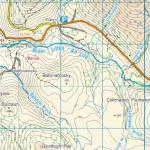
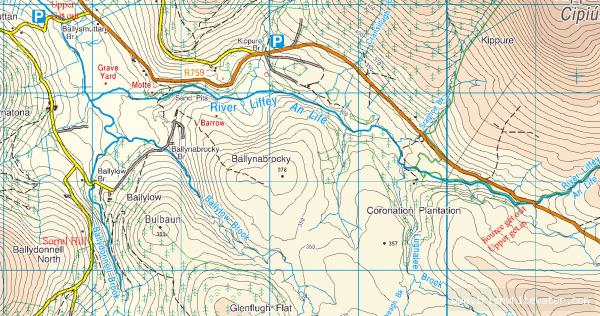
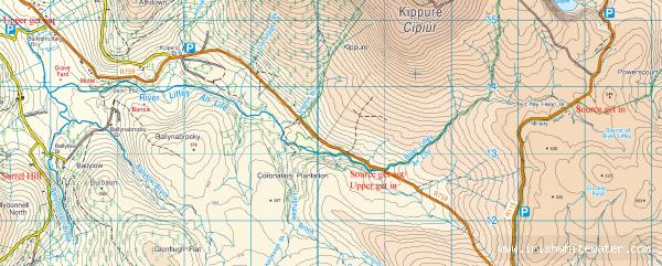
Ballydonnell Brock is located in between Sorrell Hill and Seefigan. South of the R759. To make the most of this river it is best to use the take out for the Upper Liffey as the finish, this is located at the Ballysmuttan bridge on the Manor Kilbride road.
The river can then be accessed in two ways:
Sorrel Hill Side
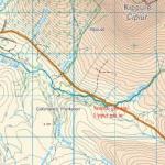
From Ballysmuttan bridge, drive uphill on the river left side, the same bank as normal get out, turning left in the direction of Sorrel Hill. Follow the road, and take the first right, for about 4km climbing all the time. When the surface of the road dramatically deteriorates you're nearly there. Park at the entrance to a forest track that descends down into the river valley. Accessing the river is by following the forest track and a short descent directly through the trees.
River Right Bank
Like the other put in, when you set out from the Ballysmuttan bridge take the left turning in the direction of Sorrel Hill. Unlike the other put in, continue straight on down that road towards the bridge further up the river. When you cross the bridge, take the next forest track is on the right, its about hundred meters from bridge. Park here and carry on down the track until you get close to the river.
Usual take out for Upper Liffey at Ballysmutten Bridge.
Interactive map loading...
Ballydonnell Brook
p
Ballydonnell Brook and Upper Liffey
Peter