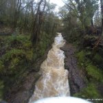
Lots of drops, rapids and holes. The main section, which includes the Main Falls, the Double Drop are ideally situated for spectators and photos. Always a good day out.
Top Drop
The Top Drop waterfall, a straight forward 9 foot waterfall.
Sidewinder
A drop that require a sudden change of direction to the right midair or upon landing.
Constriction
The Constriction is just below Sidewinder. It is a narrow slot, where the river is squeezed into two boat widths. On high water a breaking wave appears at its mouth, this can back loop some lower volume boats.
There is a break and then some more generic, but exciting rapids between this and the next section.
The Foot bridge
On high level when you see the foot bridge (or before it) this is where you get out because there are no further get out points until after the Big Eas waterfall.
The foot bridge has a sometimes sticky little hole under it just before the rapid that leads into Big Eas. The line is river right though this, hard river right on big water.
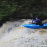
Big Eas Waterfall
Rapids leading into Big Eas Waterfall consist of a steepish section just below the footbridge. Then a fast rapid with lots of breaking waves. At the end of this the river turns almost 90 degrees and shoots 15 feet of Big Eas waterfall.
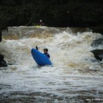
The Double Drop/Little Eas
Immediately after the plunge pool of Big Eas.Little Eas consists of two slides/drops that drop about 15feet. This can get sticky on high water, inspect yourself each time to get an idea of where the tow back is. Generally running it river right is a safe bet.
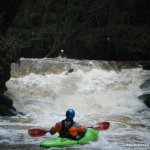
The rest is fairly technical grade 3 river running, with some rapids/drops.
Below the Bridge
At levels above 0.5 on the gauge the drops below the take out become worth while. The first drop is not very pretty and should be inspected, the are another 3 drops below this which are quite friendly. Take out on river right and walk through fields for 300m to a gate by the road at the noraml take out. These drops are surprisingly worth while but beware of trees on this section.
Car's have been broken before. Also the Locals dont like their gates being blocked by parked cars. When parking at the usual put in there is a yard on the right hand side before the rhododendrons. Pull in there but don't block any of the gates.
The Meter under the bridge at the car park.
-0.4 Runnable
-0.7 High
Clare glens River gauge Located under the bridge at the take out car park
Above gauge washed away in 2012
Ref OPW on line gauge 25309 at Clonshingle Bridge
http://waterlevel.ie/0000025309/0001/day/
Map to the Clare glens river
Take Out at the bridge beside the car park.
Interactive map loading...
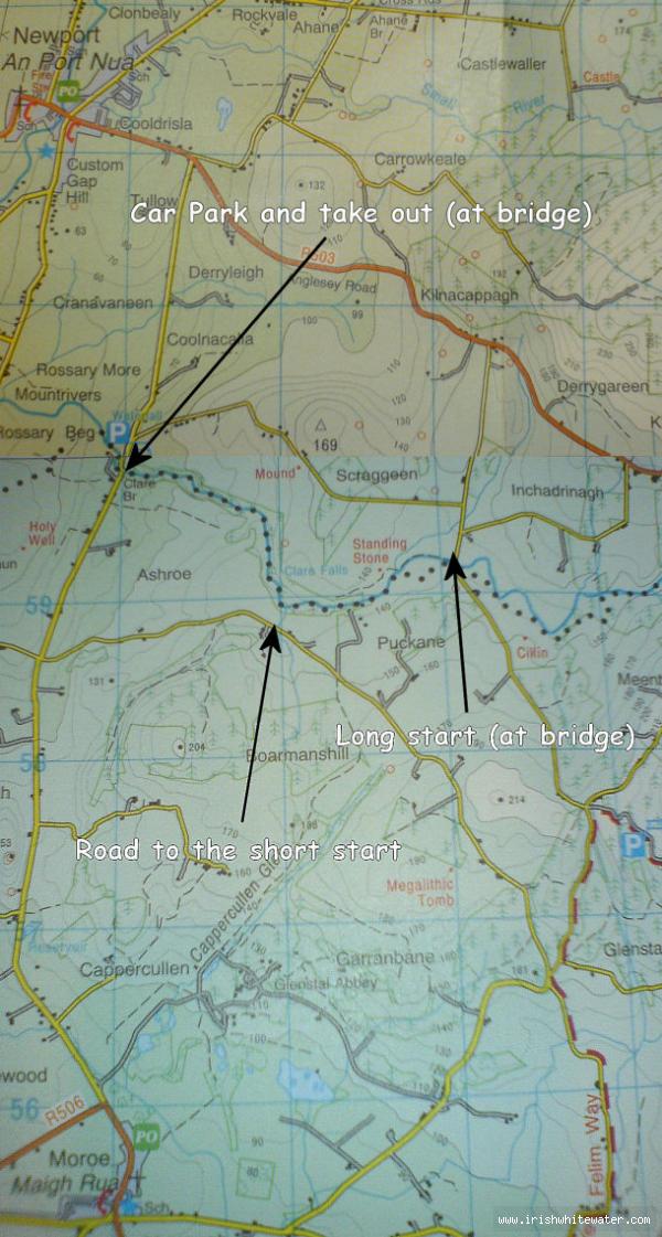
Map of the Clare glens river
Seanie Byrne