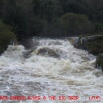
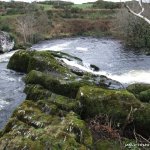
This is a nice day - not a mind blower but the main drop mid way through provides something of interest. After putting in, things continue at an easy difficulty level for 1/4 of a mile. There are sporadic sets of small rapids and 1 section which can be overgrown with branches requiring some ducking and dodging. The main drop is marked by the river closing in on both sides - to the right with branches, to the left with an earthen bank. The drop is usually run by continuing through the slot/channel that shoots right.
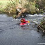
The Big Drop can now be run on far River Right at high levels ( above 0.7m ) as the trees have been trimmed back ( 12/07 see picture )
Below there is a large pool for recovery. Afterwards there is a boulder garden section, watch out for the dead tree on river left at the end of this section. and the river slows down with a long flat water section at the end. Take out is just before the main bridge on river left in Dunmanway.
There is now a tree down on the entrance to the S-Bend on River Right, some of it has been cut back though ( 12/07 see picture )
The main drop is worth scouting if you have not paddled the river before.
Low lying branches close in on 1 section and are worth mentioning.
Loading levels...
Written by paddlers. If you know this river, sign in and edit these notes. Changes are reviewed before they appear.
There is a gauge by the bridge in Dunmanway. The Upper Bandon rises and falls quite quickly.
Can be ran at minimum of -0.2, but very scrapy at this level
Below 0.2, it is hardly worth it.
At medium levels, its mostly 2+, 3- apart from the big drop.
At 0.6m and above the rapid sections will get pushier (4).
The last km to Dunmanway is always a flat slog,
Typical number of days each month the river is at a paddling level
| Month | Typical paddle days | Driest year | Wettest year | Years with at least one paddle day |
|---|---|---|---|---|
| January | 11 | 3 | 21 | 8 of 8 |
| February | 14 | 1 | 19 | 8 of 8 |
| March | 10 | 2 | 21 | 8 of 8 |
| April | 4 | 0 | 9 | 6 of 8 |
| May | 3 | 0 | 10 | 5 of 8 |
| June | 3 | 0 | 5 | 7 of 8 |
| July | 0 | 0 | 9 | 3 of 8 |
| August | 2 | 0 | 13 | 5 of 8 |
| September | 4 | 0 | 8 | 7 of 8 |
| October | 12 | 5 | 23 | 7 of 7 |
| November | 15 | 3 | 20 | 8 of 8 |
| December | 14 | 9 | 19 | 8 of 8 |
The best months on the Upper Bandon are February, November and December, with 14 to 15 paddle days in a typical month. Summer is hit and miss: a typical June to August month gives only about 2 paddle days, but July had at least one paddle day in 3 of the last 8 years.
How to read this graph. A paddle day is a day the gauge reached between the guide's Low and High levels (0.5 to 1.5 m). Each bar is the middle year of 8 (2018 to 2026). Tap a bar for the driest and wettest years.
How high the river usually gets each day, from 8 years of readings (2018 to 2026)
| Month | Typical daily high | 8 days in 10 between |
|---|---|---|
| January | 0.478 m | 0.196 and 1.572 m |
| February | 0.606 m | 0.195 and 1.681 m |
| March | 0.41 m | 0.147 and 1.332 m |
| April | 0.226 m | 0.116 and 0.709 m |
| May | 0.186 m | 0.106 and 0.585 m |
| June | 0.158 m | 0.104 and 0.481 m |
| July | 0.131 m | 0.064 and 0.415 m |
| August | 0.181 m | 0.032 and 0.642 m |
| September | 0.19 m | 0.097 and 0.966 m |
| October | 0.613 m | 0.213 and 1.709 m |
| November | 0.587 m | 0.213 and 1.684 m |
| December | 0.669 m | 0.218 and 1.699 m |
How to read this graph. The line is the typical daily high; the shaded band covers 8 days in 10. Dashed lines are this guide's levels.
Past levels are no guarantee of future conditions. Readings can be late or wrong: check the river on the day. Level colours, "Running now" and paddle days are a guide only, not a sign that the river is safe to paddle. Read about gauge data and levels.
Levels for this guide: whitewater.guide (CC licensed).
Contains Irish Public Sector Information licensed under a Creative Commons Attribution 4.0 International (CC BY 4.0) licence (source waterlevel.ie, provided by the Office of Public Works).
Put In From Cork City Direction: Drive into Dunmanway town and take the first right by the petrol station. Continue out this road for 3km and take the first turn to the left ( signposted for The Birth Place of Sam Maguire ) just before a concrete bridge over the river. Continue up this road for 1.7km until you get to a crossroads. Turn right and drive 0.3km until you come to the river. There is space for 1 car at this point.
Take Out: Take out is at the bridge coming into Dunmanway town from the Cork direction. There is ample space along the road for parking. Note: the big drop can be scouted before hand by stopping at a gateway on the bohereen. Keep checking the river to the right of the road until you see a large pool which is just below the drop. There does not appear to be access problems but respect the area surrounding the drop if cattle are present.
Interactive map loading...
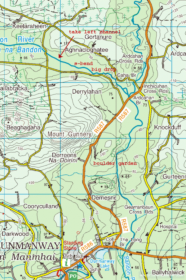
Upper Bandon Map, Credit goes to UCC for this.
Dave P